
- Start >
- Rivers >
- Waterlevel >
- Iller - Lech - Bodensee >
- Görisried >
- Current values

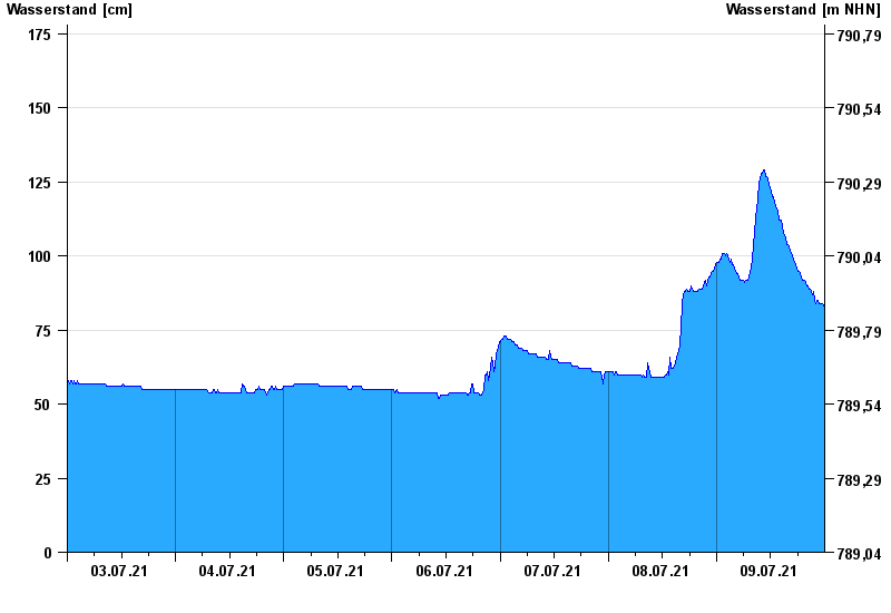
Current values Görisried / Waldbach
Waterlevel from 03.07.2021 to 09.07.2021
| Date | Waterlevel [cm] |
|---|---|
| 10.07.2021 00:45 | 82 |
| 10.07.2021 00:30 | 82 |
| 10.07.2021 00:15 | 83 |
| 10.07.2021 00:00 | 83 |
| 09.07.2021 23:45 | 83 |
| 09.07.2021 23:30 | 84 |
| 09.07.2021 23:15 | 84 |
© Bayerisches Landesamt für Umwelt 2024