
- Start >
- Rivers >
- Waterlevel >
- Oberer Main - Elbe >
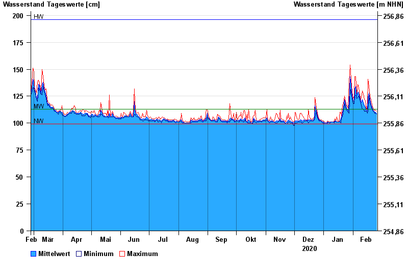
- Untermerzbach >
- Chart of year

Chart of year Untermerzbach / Merzbach
Waterlevel from 27.02.2020 to 26.02.2021
| Date | Mean value [cm] | Maximum [cm] | Minimum [cm] |
|---|---|---|---|
| 26.02.2021 | 109 | 111 | 108 |
| 25.02.2021 | 110 | 112 | 109 |
| 24.02.2021 | 110 | 112 | 109 |
| 23.02.2021 | 111 | 112 | 110 |
| 22.02.2021 | 112 | 114 | 111 |
| 21.02.2021 | 115 | 117 | 113 |
| 20.02.2021 | 117 | 122 | 116 |
© Bayerisches Landesamt für Umwelt 2024