
- Start >
- Rivers >
- Waterlevel >
- Oberer Main - Elbe >
- Unterhammer >
- Chart of month

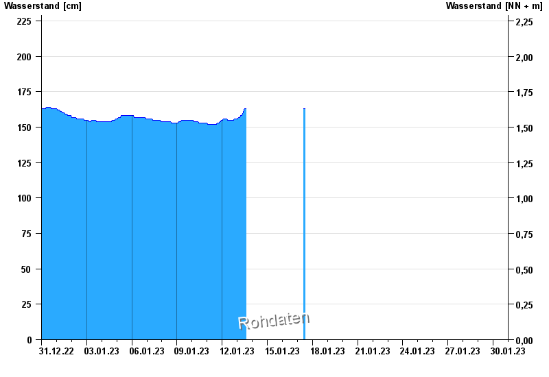
Chart of month Unterhammer / Südliche Regnitz
Waterlevel from 31.12.2022 to 30.01.2023
note
Kein Netz
| Date | Waterlevel [cm] |
|---|---|
| 17.01.2023 12:30 | 163 |
| 17.01.2023 12:15 | 163 |
| 17.01.2023 12:00 | 163 |
| 17.01.2023 11:45 | 163 |
| 17.01.2023 11:30 | 163 |
| 17.01.2023 11:15 | 163 |
| 17.01.2023 11:00 | 163 |
© Bayerisches Landesamt für Umwelt 2024