
- Start >
- Rivers >
- Waterlevel >
- Oberer Main - Elbe >
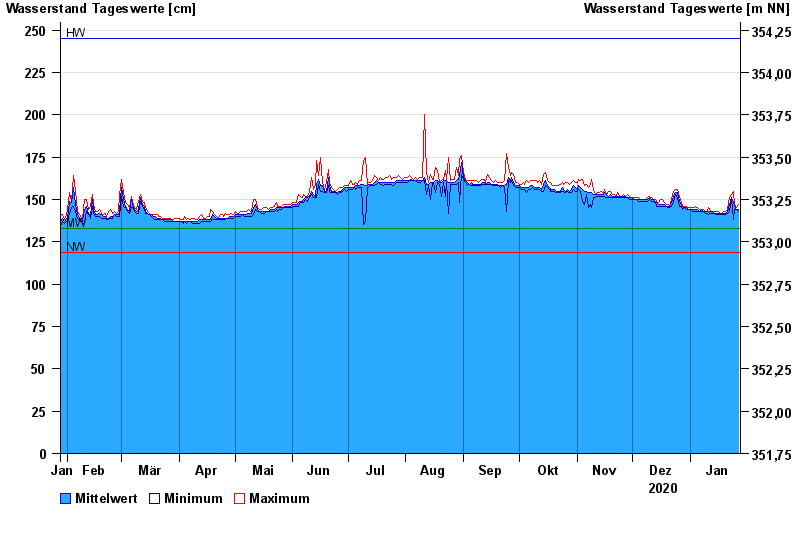
- Pottenstein >
- Chart of year

Chart of year Pottenstein / Püttlach
Waterlevel from 28.01.2020 to 27.01.2021
note
Abfluss durch starke Verkrautung behindert; Abflusswerte unsicher
| Date | Mean value [cm] | Maximum [cm] | Minimum [cm] |
|---|---|---|---|
| 27.01.2021 | 144 | 147 | 143 |
| 26.01.2021 | 144 | 145 | 144 |
| 25.01.2021 | 146 | 147 | 144 |
| 24.01.2021 | 148 | 155 | 138 |
| 23.01.2021 | 151 | 153 | 150 |
| 22.01.2021 | 147 | 151 | 143 |
| 21.01.2021 | 143 | 144 | 142 |
© Bayerisches Landesamt für Umwelt 2024