
- Start >
- Rivers >
- Waterlevel >
- Oberer Main - Elbe >
- Mauthaus >
- Chart of year

Chart of year Mauthaus / Tschirner Ködel
Waterlevel from 01.01.2020 to 31.12.2020
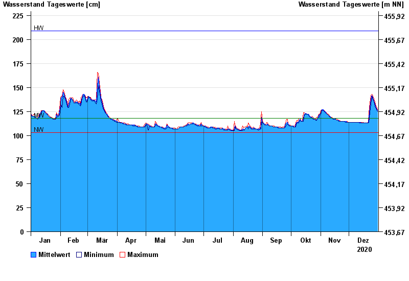
| Date | Mean value [cm] | Maximum [cm] | Minimum [cm] |
|---|---|---|---|
| 31.12.2020 | 126 | 127 | 125 |
| 30.12.2020 | 128 | 130 | 127 |
| 29.12.2020 | 131 | 132 | 129 |
| 28.12.2020 | 133 | 135 | 131 |
| 27.12.2020 | 136 | 138 | 135 |
| 26.12.2020 | 139 | 141 | 137 |
| 25.12.2020 | 142 | 143 | 141 |
© Bayerisches Landesamt für Umwelt 2024