
- Start >
- Rivers >
- Chemistry >
- Iller - Lech - Bodensee >
- Oh. Mdg. >
- Master data

Master data Oh. Mdg.
Site number: 195022
Community: Scheidegg, M
District: Lindau (Bodensee)
Operator: WWA Kempten
Body of water: Kesselbach
Catchment: --
Easting: 565808 (ETRS89 / UTM Zone 32N)
Northing: 5264289
- state measurement sites
For the measurement site Oh. Mdg. at the moment no extended master data available.
Picture of the measurement site
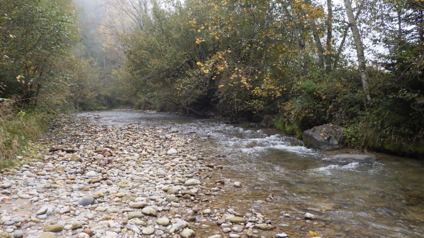
Location of the station Oh. Mdg. / Kesselbach
| Measurement site | Category |
|---|---|
 Thalkirchdorf Thalkirchdorf | Rivers: Runoff, Waterlevel |
| Aeschach | Rivers: Runoff, Waterlevel |
| Oberstaufen | Rivers: Runoff, Waterlevel |
| Zwirkenberg | Rivers: Runoff, Waterlevel |
| Seltmans | Rivers: Runoff, Waterlevel |
| Lindau | Lakes: Waterlevel, Water temperature, Water temperature |
| Br. uh. Staatsgrenze | Rivers: Chemistry, Biology |
| Uh. Grenze Hörbranz | Rivers: Chemistry, Biology |
| Oh. Lacherhofbach, uh. ehem. KA Weiler | Rivers: Chemistry, Biology |
| Oh. Mdg. Wolfsbach | Rivers: Chemistry, Biology |
| Oberschmitten | Rivers: Chemistry, Biology |
| Oh. Mdg. | Rivers: Chemistry, Biology |
| Br. uh.Hochgratbahn, uh. Lanzenbach | Rivers: Chemistry, Biology |
| Wegbr. Gerisgschwend | Rivers: Chemistry, Biology |
| oh. Staatsgrenze | Rivers: Chemistry, Biology |
| oh. Mdg. Rickenbach | Rivers: Chemistry, Biology |
| Oh. Mdg. Leiblach | Rivers: Chemistry, Biology |
| Brücke Seltmanns | Rivers: Chemistry, Biology |
| Straßenbr. oh. Untermooweiler | Rivers: Chemistry, Biology |
| Uh. Straßenbr. Giesenberg | Rivers: Chemistry, Biology |
| 0,1 km oh. Mdg. Bolsternanger Bach | Rivers: Chemistry, Biology |
| Lindau-Zech oh. Mündung | Rivers: Chemistry |
| Uh. Eibele Wasserfälle | Rivers: Chemistry, Biology |
| Strabrü Siebers-Eyenbach | Rivers: Chemistry, Biology |
| Klausenmühle uh. Wehr | Rivers: Biology |
| Br. bei Krummensteg | Rivers: Biology |
| Wegbr. Geratsried-Trabers | Rivers: Biology |
| Schweinbergerquelle | Groundwater: Flow of well |
| HANDWERKS/MUELHA. 794 | Groundwater: Upper groundwater layer |
| Handwerksgruppe Sigmarszell GWM 3/05 WV | Groundwater: Upper groundwater layer |
| 4110832500009 | Groundwater: Chemistry |
| 4120842500023 | Groundwater: Chemistry |
| 4120852600001 | Groundwater: Chemistry |
| 4120832600018 | Groundwater: Chemistry |
| 4120842400050 | Groundwater: Chemistry |
| 4120842600017 | Groundwater: Chemistry |
| Oberstaufen-Thalkirchdorf | Meteorology: Precipitation |
| Weiler-Simmerberg (Kläranlage) | Meteorology: Precipitation, Snow |
| Schwand | Meteorology: Precipitation, Wind, Air temperatur, Air moisture |
| Streitelsfingen | Meteorology: Precipitation, Wind, Air temperatur, Air moisture |
| Schönau | Meteorology: Precipitation, Wind, Air temperatur, Air moisture, Global radiation |
| Hörmoos 2 | Meteorology: Precipitation, Snow, Air moisture |
| Hörmoos 1 | Meteorology: Air temperatur |
© Bayerisches Landesamt für Umwelt 2026