
- Start >
- Rivers >
- Biology >
- Isar >
- Br. östl. Schainbach >
- Master data

Master data Br. östl. Schainbach
Site number: 3288
Community: Ehekirchen
District: Neuburg-Schrobenhausen
Operator: WWA Ingolstadt
Body of water: Reutfleckgraben
Catchment: --
Easting: 655415 (ETRS89 / UTM Zone 32N)
Northing: 5386584
- state measurement sites
For the measurement site Br. östl. Schainbach at the moment no extended master data available.
Picture of the measurement site
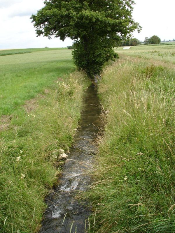
Location of the station Br. östl. Schainbach / Reutfleckgraben
| Measurement site | Category |
|---|---|
 Bertoldsheim KW Bertoldsheim KW | Rivers: Runoff |
| Bittenbrunn KW | Rivers: Runoff |
| Neuburg | Rivers: Runoff, Waterlevel |
| Augsburg u. d. Wertachmündung | Rivers: Runoff, Waterlevel |
| Augsburg Oberhausen | Rivers: Runoff, Waterlevel |
| Rennertshofen | Rivers: Runoff, Waterlevel |
| Dasing | Rivers: Runoff, Waterlevel |
| Aichach Blauer Steg | Rivers: Runoff, Waterlevel |
| Mühlried | Rivers: Runoff, Waterlevel |
| Blumenthal | Rivers: Runoff, Waterlevel |
| Altenfurt | Rivers: Runoff, Waterlevel |
| Pöttmes | Rivers: Runoff, Waterlevel |
| Weichering | Rivers: Runoff, Waterlevel |
| Grabmühle | Rivers: Waterlevel |
| Deutenhofen | Rivers: Waterlevel |
| KW Feldheim OW | Rivers: Chemistry |
| BITTENBRUNN KW-OW | Rivers: Chemistry, Biology |
| Br Hunzenhof | Rivers: Chemistry |
| Br. Moosmühle | Rivers: Chemistry |
| BRUECKE HATZENHOFEN | Rivers: Chemistry |
| Br. Dünzlau | Rivers: Chemistry, Biology |
| Br westl Hoerzhausen | Rivers: Chemistry, Biology |
| Br.westl. Mühlried | Rivers: Chemistry |
| Schlagmühle Gempfing | Rivers: Chemistry |
| L3 70m oh Br. Staust. Bergheim | Rivers: Chemistry, Biology |
| Segelflugplatz Burgheim | Rivers: Chemistry, Biology |
| Straßenbr oh Einmdg Kabisbach | Rivers: Chemistry, Biology |
| Straßenbr. Baierfeld-Hochfeld | Rivers: Chemistry, Biology |
| oh. Dickelsmoor - oh. Fischzucht | Rivers: Chemistry, Biology |
| uh. ehem. KA Gebenhofen | Rivers: Chemistry, Biology |
| uh Appertshausen | Rivers: Chemistry, Biology |
| 300m uh KA Friedberg-Nord | Rivers: Chemistry, Biology |
| 80m uh Amtsgrenze | Rivers: Chemistry, Biology |
| uh Dücker/Brücke uh Feldmühle | Rivers: Chemistry, Biology |
| oh. Br. Oberschwaig | Rivers: Chemistry, Biology |
| Oh Mdg in die Paar | Rivers: Chemistry |
| Wolfzahnauwehr OW | Rivers: Chemistry |
| oh. Br. südliches Ortsende Zell | Rivers: Chemistry, Biology |
| 1km uh Br Altmannstetten | Rivers: Chemistry, Biology |
| Br. südl. KA Dinkelshausen | Rivers: Chemistry, Biology |
| oh. Str.br. Warching | Rivers: Chemistry, Biology |
| 1 km oh. Br. Thierh. - Mutterbett (km 22,25) | Rivers: Chemistry, Biology |
| Straßenbrücke oh. Mündung in Ach | Rivers: Chemistry |
| Kraftwerk OW | Rivers: Chemistry |
| Brücke St 2047 | Rivers: Chemistry |
| oh. Lechsend | Rivers: Chemistry, Biology |
| Bittenbrunn 700 m uh KW | Rivers: Chemistry, Biology |
| Br. Herbertshofen | Rivers: Chemistry |
| uh. KA ZV Kabisbachgruppe | Rivers: Chemistry, Biology |
| Kuhbrücke oestl. Niederschönenfeld | Rivers: Chemistry |
| 700m oh Mündung in Ach | Rivers: Chemistry, Biology |
| Br. Genderkingen-Rain | Rivers: Chemistry |
| Neuburg Brandlbad Schwebstoff | Rivers: Chemistry |
| ehemaliges Goggeleswehr | Rivers: Chemistry, Biology |
| Straßenbr. Blumenthal | Rivers: Chemistry, Biology |
| Straßenbr. Dasing B 300 | Rivers: Chemistry |
| Br Tödtenried | Rivers: Chemistry |
| Hörzhausen | Rivers: Chemistry |
| Zulauf Sedimentbecken | Rivers: Chemistry |
| Br. Waldrand Kochheim | Rivers: Chemistry, Biology |
| Straßenbr. bei Dieß | Rivers: Chemistry, Biology |
| uh. KA Pessenburgheim | Rivers: Chemistry, Biology |
| uh Deponie Südzucker | Rivers: Chemistry, Biology |
| Straßenbr. westl. Altisheim | Rivers: Chemistry, Biology |
| oh. Mdg. in die Paar | Rivers: Chemistry |
| oh. Strbr. Münster | Rivers: Chemistry, Biology |
| oh. KA Hollenbach | Rivers: Chemistry, Biology |
| 300 m oh Moos | Rivers: Biology |
| 500m uh Trugenhofen | Rivers: Biology |
| Wegbr. nach Gallenbach | Rivers: Biology |
| Br. uh. KA Aresing | Rivers: Biology |
| Br. östl. Schainbach | Rivers: Biology |
| L1 Steg 2,6 km oh. Mündung | Rivers: Biology |
| 70m uh Furt unterhalb Trugenhofen | Rivers: Biology |
| Unterweilenbach | Groundwater: Upper groundwater layer |
| Genderkingen Bhf. 64a | Groundwater: Upper groundwater layer |
| Thierhaupten D 41 | Groundwater: Upper groundwater layer |
| SCHNOEDHOF 111 | Groundwater: Upper groundwater layer |
| HEINRICHSHEIM 34.02 | Groundwater: Upper groundwater layer |
| Niederschönenfeld 109B | Groundwater: Upper groundwater layer |
| Rehling St. Stephan D36 | Groundwater: Upper groundwater layer |
| GEROLFING B | Groundwater: Upper groundwater layer |
| Schnödhof-Kapelle Q4 | Groundwater: Upper groundwater layer |
| Buxheim Moosmühle 120 NEU | Groundwater: Upper groundwater layer |
| Ammerfeld, B1 | Groundwater: Upper groundwater layer |
| PIPINSRIED T2f | Groundwater: Deep groundwater layer |
| PIPINSRIED T2t | Groundwater: Deep groundwater layer |
| Hollenbach | Groundwater: Deep groundwater layer |
| BERGHEIM B4 | Groundwater: Deep groundwater layer |
| Obergriesbach T5 | Groundwater: Deep groundwater layer |
| Gempfing W4 | Groundwater: Deep groundwater layer |
| Haslangkreit T6 | Groundwater: Deep groundwater layer |
| RAIN 112 | Groundwater: Upper groundwater layer |
| MUEHLHAUSEN 742 | Groundwater: Upper groundwater layer |
| LECHHAUSEN 642 | Groundwater: Upper groundwater layer |
| LECHHAUSEN 643 | Groundwater: Upper groundwater layer |
| LECHHAUSEN 645 | Groundwater: Upper groundwater layer |
| LECHHAUSEN 98B | Groundwater: Upper groundwater layer |
| DERCHING 638 A | Groundwater: Upper groundwater layer |
| Lechhausen 640 A | Groundwater: Upper groundwater layer |
| GERSTHOFEN TB NR. 9 | Groundwater: Deep groundwater layer |
| TODTENWEIS 738 | Groundwater: Upper groundwater layer |
| DERCHING 638 | Groundwater: Upper groundwater layer |
| LECHHAUSEN 640 | Groundwater: Upper groundwater layer |
| FELDKIRCHEN 116A | Groundwater: Upper groundwater layer |
| SCHROBENHAUSEN D 17 | Groundwater: Upper groundwater layer |
| LICHTENAU B1 | Groundwater: Deep groundwater layer |
| HATZENHOFEN HA 2 | Groundwater: Upper groundwater layer |
| Hitzhofen GWM 7 | Groundwater: Upper groundwater layer |
| Dollnstein | Groundwater: Upper groundwater layer |
| LICHTENAU 45.02 | Groundwater: Upper groundwater layer |
| BURGHEIM 921 | Groundwater: Upper groundwater layer |
| DUENZLAU B5 | Groundwater: Deep groundwater layer |
| MITTELSTETTEN MS/12A | Groundwater: Upper groundwater layer |
| RAIN II_2 | Groundwater: Upper groundwater layer |
| OBERPEICHING OP/24 | Groundwater: Upper groundwater layer |
| Ellgau EL_05 (Ob_102) | Groundwater: Upper groundwater layer |
| Oberndorf I_2 | Groundwater: Upper groundwater layer |
| MUENSTER/GUT SULZ 106_B | Groundwater: Upper groundwater layer |
| DERCHING 637 | Groundwater: Upper groundwater layer |
| DERCHING 639 | Groundwater: Upper groundwater layer |
| DERCHING 636 | Groundwater: Upper groundwater layer |
| GERSTHOFEN 97 | Groundwater: Upper groundwater layer |
| AUGSBG.LECHHAUSEN 98A | Groundwater: Upper groundwater layer |
| ANWALTING 99 | Groundwater: Upper groundwater layer |
| ANWALTING 99B | Groundwater: Upper groundwater layer |
| Gersthofen_LEW_TB_1 | Groundwater: Upper groundwater layer |
| MARXHEIM MX 11 | Groundwater: Upper groundwater layer |
| MARXHEIM MX 117 | Groundwater: Upper groundwater layer |
| MARXHEIM MX 14 | Groundwater: Upper groundwater layer |
| FELDHEIM FE 5 | Groundwater: Upper groundwater layer |
| RAIN AM LECH/BPL. 108 | Groundwater: Upper groundwater layer |
| NIEDERSCHOENENFELD109 | Groundwater: Upper groundwater layer |
| MITTELSTETTEN 110 | Groundwater: Upper groundwater layer |
| STAUDHEIM 113 | Groundwater: Upper groundwater layer |
| RAIN/LECH 108A | Groundwater: Upper groundwater layer |
| STAETZLING 96A | Groundwater: Upper groundwater layer |
| THIERHAUPTEN I D 85 | Groundwater: Upper groundwater layer |
| WINDEN 595 | Groundwater: Upper groundwater layer |
| LECHHAUSEN 641 | Groundwater: Upper groundwater layer |
| LECHHAUSEN 644 (08199) | Groundwater: Upper groundwater layer |
| THIERHAUPTEN OETZ 105 | Groundwater: Upper groundwater layer |
| LANGWEID 557 | Groundwater: Upper groundwater layer |
| THIERHAUPTEN-N. D 35 | Groundwater: Upper groundwater layer |
| THIERHAUPTEN D 42 | Groundwater: Upper groundwater layer |
| Oberndorf I_1 | Groundwater: Upper groundwater layer |
| MITTELSTETTEN MS/12 | Groundwater: Upper groundwater layer |
| FELDHEIM III/1 | Groundwater: Upper groundwater layer |
| NIEDERSCHOENENFELD109A | Groundwater: Upper groundwater layer |
| Ellgau 101 | Groundwater: Upper groundwater layer |
| REHLING 739 | Groundwater: Upper groundwater layer |
| REHLING 740 | Groundwater: Upper groundwater layer |
| LECHHAUSEN 646 | Groundwater: Upper groundwater layer |
| GERSTHOFEN 647A | Groundwater: Upper groundwater layer |
| GERSTHOFEN 648 | Groundwater: Upper groundwater layer |
| GERSTHOFEN 649A | Groundwater: Upper groundwater layer |
| KUEHBACH (TB) T5 | Groundwater: Deep groundwater layer |
| THIERHAUPTEN 737 | Groundwater: Upper groundwater layer |
| WALDHAUS 741 | Groundwater: Upper groundwater layer |
| KARLSHULD 39.02 | Groundwater: Upper groundwater layer |
| LICHTENAU T 5 | Groundwater: Deep groundwater layer |
| WEICHERING II | Groundwater: Upper groundwater layer |
| WEICHERING III | Groundwater: Upper groundwater layer |
| WEICHERING 41.02 | Groundwater: Upper groundwater layer |
| KLINGSMOOS 9.1 | Groundwater: Upper groundwater layer |
| KLINGSMOOS 9.2 | Groundwater: Upper groundwater layer |
| MOOS MO 7 | Groundwater: Upper groundwater layer |
| Gietlhausen | Groundwater: Upper groundwater layer |
| STENGELHEIM 24.1 | Groundwater: Upper groundwater layer |
| STENGELHEIM 24.2 | Groundwater: Upper groundwater layer |
| SCHORN 1.1A | Groundwater: Upper groundwater layer |
| SCHORN 1.2 | Groundwater: Upper groundwater layer |
| MOOS 114A | Groundwater: Upper groundwater layer |
| OBERGRASHEIM 30.01 | Groundwater: Upper groundwater layer |
| BALLERSDORF 23.02 | Groundwater: Upper groundwater layer |
| ALTMANNSTETTEN 25.02 | Groundwater: Upper groundwater layer |
| GRABMUEHLE 11.2 | Groundwater: Upper groundwater layer |
| GRABMUEHLE 11.3 | Groundwater: Upper groundwater layer |
| SANDIZELL 5.2 | Groundwater: Upper groundwater layer |
| LANGENMOSEN T 2 | Groundwater: Upper groundwater layer |
| LICHTENAU 1 | Groundwater: Upper groundwater layer |
| GRASHEIM Q 3 | Groundwater: Upper groundwater layer |
| BRUNNEN T 3 | Groundwater: Upper groundwater layer |
| DETTENHOFEN 29.2 | Groundwater: Upper groundwater layer |
| NIEDERARNBACH 35.1A | Groundwater: Upper groundwater layer |
| NIEDERARNBACH 35.2 | Groundwater: Upper groundwater layer |
| KARLSHULD 37.01 | Groundwater: Upper groundwater layer |
| DETTENHOFEN 29.1 | Groundwater: Upper groundwater layer |
| LUDWIGSMOOS 17.1 | Groundwater: Upper groundwater layer |
| LUDWIGSMOOS 17.2 | Groundwater: Upper groundwater layer |
| BRUNNEN 27.01 | Groundwater: Upper groundwater layer |
| RIED 8.1 | Groundwater: Upper groundwater layer |
| RIED 8.2 | Groundwater: Upper groundwater layer |
| LUDWIGSMOOS 12.01 | Groundwater: Upper groundwater layer |
| LAENGENMUEHLBACH 15.1 | Groundwater: Upper groundwater layer |
| LAENGENMUEHLBACH 15.2 | Groundwater: Upper groundwater layer |
| ABENBERG 3.1 | Groundwater: Upper groundwater layer |
| ABENBERG 3.2 | Groundwater: Upper groundwater layer |
| PETTENHOFEN 121 | Groundwater: Upper groundwater layer |
| KARLSHULD T 6 | Groundwater: Deep groundwater layer |
| ROEDENHOF T 7 | Groundwater: Deep groundwater layer |
| FERNMITTENHAUSEN T 1 | Groundwater: Deep groundwater layer |
| GEROLFING 118 | Groundwater: Upper groundwater layer |
| WEICHERING 129 | Groundwater: Upper groundwater layer |
| GRASHEIM 133A | Groundwater: Upper groundwater layer |
| FELDKIRCHEN 116 | Groundwater: Upper groundwater layer |
| DUENZLAU 123 | Groundwater: Upper groundwater layer |
| WEICHERING I | Groundwater: Upper groundwater layer |
| MOOSMUEHLE BUXHM 120 | Groundwater: Upper groundwater layer |
| MOOSMUEHLE BUXHM 120A | Groundwater: Upper groundwater layer |
| OBERHAIDMUEHLE 119 | Groundwater: Upper groundwater layer |
| REINBOLDSMUEHLE 122 | Groundwater: Upper groundwater layer |
| Ger-A GEROLFING | Groundwater: Upper groundwater layer |
| Ger-C GEROLFING | Groundwater: Upper groundwater layer |
| Ger-E GEROLFING | Groundwater: Upper groundwater layer |
| Ger-G GEROLFING | Groundwater: Upper groundwater layer |
| B1 GEROLFING | Groundwater: Upper groundwater layer |
| MARIENHEIM 26.02 | Groundwater: Upper groundwater layer |
| SEHENSAND 803 | Groundwater: Upper groundwater layer |
| SANDIZELL 5.1 | Groundwater: Upper groundwater layer |
| SANDIZELL 127A | Groundwater: Upper groundwater layer |
| BSM BK 3 Habermeyer | Groundwater: Upper groundwater layer |
| BSM BK 5 Stadtwerke ND | Groundwater: Upper groundwater layer |
| RIEDENSHEIM BS13 | Groundwater: Upper groundwater layer |
| BSM 1 SOB HWF | Groundwater: Upper groundwater layer |
| BSM 2 SOB HWF | Groundwater: Upper groundwater layer |
| BSM 3 SOB HWF | Groundwater: Upper groundwater layer |
| BSM 4 SOB HWF | Groundwater: Upper groundwater layer |
| BSM 5 SOB HWF | Groundwater: Upper groundwater layer |
| BSM 6 SOB HWF | Groundwater: Upper groundwater layer |
| BSM 7 SOB HWF | Groundwater: Upper groundwater layer |
| GWM 1 Donauauen | Groundwater: Upper groundwater layer |
| GWM2 DONAUAUEN | Groundwater: Upper groundwater layer |
| GWM3 DONAUAUEN | Groundwater: Upper groundwater layer |
| GWM4 DONAUAUEN | Groundwater: Upper groundwater layer |
| GWM5 DONAUAUEN | Groundwater: Upper groundwater layer |
| GWM6 DONAUAUEN | Groundwater: Upper groundwater layer |
| GWM7 DONAUAUEN | Groundwater: Upper groundwater layer |
| GWM8 DONAUAUEN | Groundwater: Upper groundwater layer |
| GWM9 DONAUAUEN | Groundwater: Upper groundwater layer |
| UNTERWEILENBACH T5 Neu | Groundwater: Upper groundwater layer |
| GWM Straß | Groundwater: Upper groundwater layer |
| 1131743100017 | Groundwater: Chemistry |
| 1131753100088 | Groundwater: Chemistry |
| 1132733100117 | Groundwater: Chemistry |
| 1132743200079 | Groundwater: Chemistry |
| 1132763200064 | Groundwater: Chemistry |
| 4110743200003 | Groundwater: Chemistry |
| 4110743200004 | Groundwater: Chemistry |
| 1131723200024 | Groundwater: Chemistry |
| 1131723300028 | Groundwater: Chemistry |
| 1131733300048 | Groundwater: Chemistry |
| 1131743300013 | Groundwater: Chemistry |
| 4110713200012 | Groundwater: Chemistry |
| 4110723300008 | Groundwater: Chemistry |
| 1131723200025 | Groundwater: Chemistry |
| 1131743300146 | Groundwater: Chemistry |
| 1131743200035 | Groundwater: Chemistry |
| 1132723100105 | Groundwater: Chemistry |
| 1132753300341 | Groundwater: Chemistry |
| 1131713200068 | Groundwater: Chemistry |
| 1131743100186 | Groundwater: Chemistry |
| 1131723200154 | Groundwater: Chemistry |
| 1132753200296 | Groundwater: Chemistry |
| 1131723300072 | Groundwater: Chemistry |
| 1131723100164 | Groundwater: Chemistry |
| 1132713400075 | Groundwater: Chemistry |
| 1132743200109 | Groundwater: Chemistry |
| 1132733200061 | Groundwater: Chemistry |
| 1132723100159 | Groundwater: Chemistry |
| 1132733100258 | Groundwater: Chemistry |
| 1131733100003 | Groundwater: Chemistry |
| 1132763300431 | Groundwater: Chemistry |
| 1131743300199 | Groundwater: Chemistry |
| 1131743400075 | Groundwater: Chemistry |
| 1131753400425 | Groundwater: Chemistry |
| 1131723200165 | Groundwater: Chemistry |
| 1131713300099 | Groundwater: Chemistry |
| 1132763200105 | Groundwater: Chemistry |
| 1132733200059 | Groundwater: Chemistry |
| 1132733200063 | Groundwater: Chemistry |
| 1131733100367 | Groundwater: Chemistry |
| 1131743200146 | Groundwater: Chemistry |
| 1131743300200 | Groundwater: Chemistry |
| 1131763200126 | Groundwater: Chemistry |
| 1131763400422 | Groundwater: Chemistry |
| 1131743300201 | Groundwater: Chemistry |
| Dasing | Meteorology: Precipitation, Snow |
| Edelshausen | Meteorology: Precipitation, Wind, Air temperatur, Air moisture, Global radiation |
| Karlshuld | Meteorology: Precipitation, Wind, Air temperatur, Air moisture, Global radiation |
| Ainertshofen | Meteorology: Precipitation, Wind, Air temperatur, Air moisture, Global radiation |
| Burgheim | Meteorology: Wind, Air temperatur, Air moisture, Global radiation |
© Bayerisches Landesamt für Umwelt 2026