
- Start >
- Groundwater >
- Waterlevel of upper layer >
- Bayern >
- Schwebheim ku 1 >
- Current data

Current data Schwebheim ku 1
Groundwater levels of the last 12 months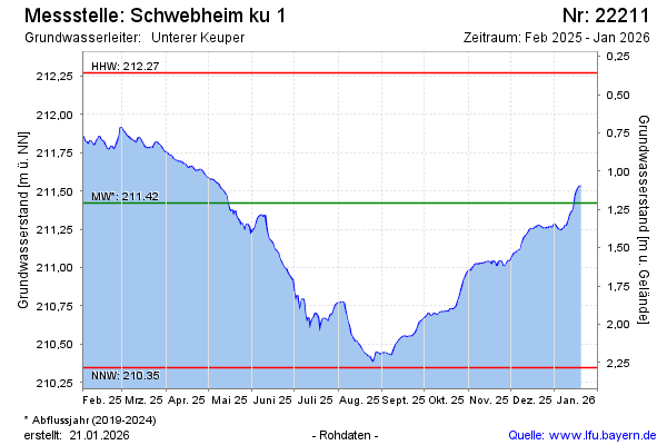
Groundwater level [m above sealevel]: 211.85
Distance to surface [m]: 0.78
Last value from 06.03.2026 08:00
Ground level [m above sealevel]: 212.63
| Date | Groundwater level [m above sealevel] |
|---|---|
| 06.03.2026 | 211.85 |
| 05.03.2026 | 211.86 |
| 04.03.2026 | 211.87 |
| 03.03.2026 | 211.88 |
| 02.03.2026 | 211.90 |
| 01.03.2026 | 211.91 |
| 28.02.2026 | 211.94 |
| 27.02.2026 | 211.96 |
© Bayerisches Landesamt für Umwelt 2026