
- Start >
- Groundwater >
- Waterlevel of upper layer >
- Bayern >
- MOOSHAEUSL 909A >
- Current data

Current data MOOSHAEUSL 909A
Groundwater levels of the last 12 months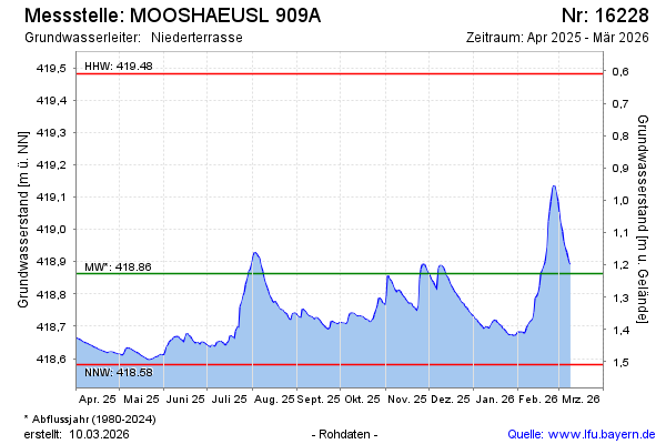
Groundwater level [m above sealevel]: 418.81
Distance to surface [m]: 1.28
Last value from 18.12.2025 10:00
Ground level [m above sealevel]: 420.09
| Date | Groundwater level [m above sealevel] |
|---|---|
| 18.12.2025 | 418.81 |
| 17.12.2025 | 418.82 |
| 16.12.2025 | 418.83 |
| 15.12.2025 | 418.84 |
| 14.12.2025 | 418.85 |
| 13.12.2025 | 418.86 |
| 12.12.2025 | 418.87 |
| 11.12.2025 | 418.88 |
© Bayerisches Landesamt für Umwelt 2025