
- Start >
- Groundwater >
- Waterlevel of upper layer >
- Bayern >
- LOHR A. MAIN/FARBMUEH. >
- Chart of total period

Chart of total period LOHR A. MAIN/FARBMUEH.
Groundwater levels of the total period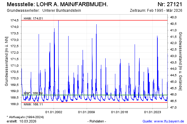
Groundwater level [m above sealevel]: 168.51
Distance to surface [m]: 46.23
Last value from 16.01.2026 10:00
Ground level [m above sealevel]: 214.74
| Date | Groundwater level [m above sealevel] |
|---|---|
| 16.01.2026 | 168.50 |
| 15.01.2026 | 168.46 |
| 14.01.2026 | 168.40 |
| 13.01.2026 | 168.34 |
| 12.01.2026 | 168.31 |
| 11.01.2026 | 168.34 |
| 10.01.2026 | 168.37 |
| 09.01.2026 | 168.29 |
© Bayerisches Landesamt für Umwelt 2026