
- Start >
- Groundwater >
- Waterlevel of upper layer >
- Bayern >
- Isarvorland P2 >
- Current data

Current data Isarvorland P2
Groundwater levels of the last 12 months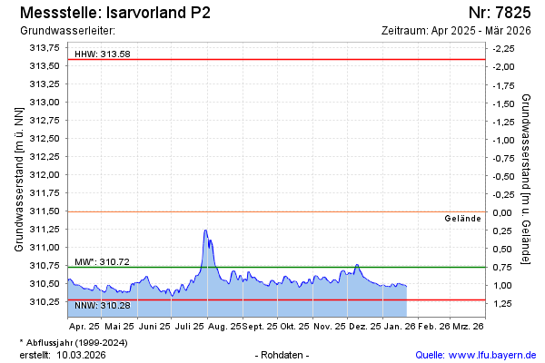
note
GW Messstelle im SN Isarvorland
Groundwater level [m above sealevel]: 310.57
Distance to surface [m]: 0.91
Last value from 10.11.2025 11:40
Ground level [m above sealevel]: 311.48
| Date | Groundwater level [m above sealevel] |
|---|---|
| 10.11.2025 | 310.57 |
| 09.11.2025 | 310.55 |
| 08.11.2025 | 310.55 |
| 07.11.2025 | 310.55 |
| 06.11.2025 | 310.57 |
| 05.11.2025 | 310.59 |
| 04.11.2025 | 310.60 |
| 03.11.2025 | 310.60 |
© Bayerisches Landesamt für Umwelt 2025