
- Start >
- Groundwater >
- Waterlevel of upper layer >
- Bayern >
- Gochsheim Q 5 >
- Chart of total period

Chart of total period Gochsheim Q 5
Groundwater levels of the total period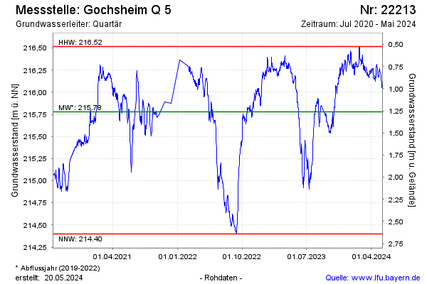
Groundwater level [m above sealevel]: 216.01
Distance to surface [m]: 0.97
Last value from 17.01.2026 08:00
Ground level [m above sealevel]: 216.98
| Date | Groundwater level [m above sealevel] |
|---|---|
| 17.01.2026 | 216.01 |
| 16.01.2026 | 216.03 |
| 15.01.2026 | 216.03 |
| 14.01.2026 | 215.99 |
| 13.01.2026 | 216.00 |
| 12.01.2026 | 215.97 |
| 11.01.2026 | 215.92 |
| 10.01.2026 | 215.99 |
© Bayerisches Landesamt für Umwelt 2026