
- Start >
- Groundwater >
- Waterlevel of upper layer >
- Bayern >
- FRIDOLFING 377 >
- Current data

Current data FRIDOLFING 377
Groundwater levels of the last 12 months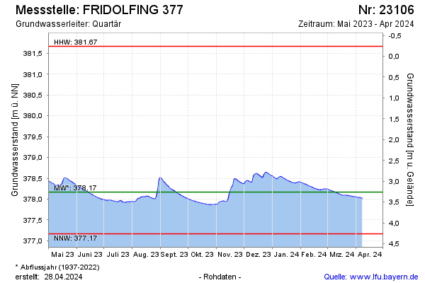
Groundwater level [m above sealevel]: 377.93
Distance to surface [m]: 3.50
Last value from 13.11.2025 10:00
Ground level [m above sealevel]: 381.43
| Date | Groundwater level [m above sealevel] |
|---|---|
| 13.11.2025 | 377.92 |
| 12.11.2025 | 377.92 |
| 11.11.2025 | 377.92 |
| 10.11.2025 | 377.92 |
| 09.11.2025 | 377.91 |
| 08.11.2025 | 377.91 |
| 07.11.2025 | 377.91 |
| 06.11.2025 | 377.91 |
© Bayerisches Landesamt für Umwelt 2025