
- Start >
- Groundwater >
- Waterlevel of upper layer >
- Bayern >
- ETTAL (Q-1) >
- Chart of total period

Chart of total period ETTAL (Q-1)
Groundwater levels of the total period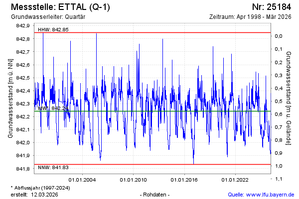
Groundwater level [m above sealevel]: 841.98
Distance to surface [m]: 0.84
Last value from 18.01.2026 23:00
Ground level [m above sealevel]: 842.82
| Date | Groundwater level [m above sealevel] |
|---|---|
| 18.01.2026 | 841.99 |
| 17.01.2026 | 841.99 |
| 16.01.2026 | 841.99 |
| 15.01.2026 | 842.00 |
| 14.01.2026 | 842.00 |
| 13.01.2026 | 842.01 |
| 12.01.2026 | 842.01 |
| 11.01.2026 | 842.01 |
© Bayerisches Landesamt für Umwelt 2026