
- Start >
- Groundwater >
- Waterlevel of upper layer >
- Bayern >
- ENGELSBERG D 7 A >
- Chart of total period

Chart of total period ENGELSBERG D 7 A
Groundwater levels of the total period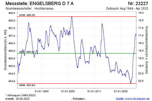
Groundwater level [m above sealevel]: 455.80
Distance to surface [m]: 18.72
Last value from 04.12.2025 12:18
Ground level [m above sealevel]: 474.52
| Date | Groundwater level [m above sealevel] |
|---|---|
| 04.12.2025 | 455.79 |
| 03.12.2025 | 455.80 |
| 02.12.2025 | 455.81 |
| 01.12.2025 | 455.81 |
| 30.11.2025 | 455.82 |
| 29.11.2025 | 455.82 |
| 28.11.2025 | 455.83 |
| 27.11.2025 | 455.83 |
© Bayerisches Landesamt für Umwelt 2026