
- Start >
- Groundwater >
- Waterlevel of upper layer >
- Bayern >
- Ellgau 101 >
- Chart of total period

Chart of total period Ellgau 101
Groundwater levels of the total period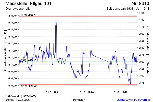
Groundwater level [m above sealevel]: 417.08
Distance to surface [m]: 3.02
Last value from 14.06.1948 12:00
Ground level [m above sealevel]: 420.10
| Date | Groundwater level [m above sealevel] |
|---|---|
| 07.06.1948 | 417.21 |
| 31.05.1948 | 417.19 |
| 24.05.1948 | 417.08 |
| 18.05.1948 | 417.28 |
| 10.05.1948 | 417.24 |
| 03.05.1948 | 417.23 |
| 26.04.1948 | 417.22 |
| 19.04.1948 | 417.11 |
© Bayerisches Landesamt für Umwelt 2026