
- Start >
- Groundwater >
- Waterlevel of deep layer >
- Bayern >
- Waldzell S 2 >
- Current data

Current data Waldzell S 2
Groundwater levels of the last 12 months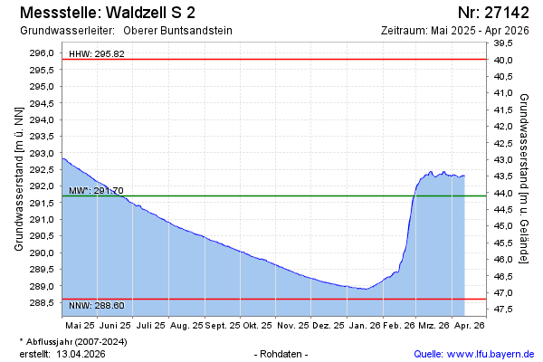
Groundwater level [m above sealevel]: 289.06
Distance to surface [m]: 46.74
Last value from 17.12.2025 10:00
Ground level [m above sealevel]: 335.80
| Date | Groundwater level [m above sealevel] |
|---|---|
| 16.12.2025 | 289.09 |
| 15.12.2025 | 289.10 |
| 14.12.2025 | 289.10 |
| 13.12.2025 | 289.10 |
| 12.12.2025 | 289.11 |
| 11.12.2025 | 289.13 |
| 10.12.2025 | 289.13 |
| 09.12.2025 | 289.15 |
© Bayerisches Landesamt für Umwelt 2025