
- Start >
- Groundwater >
- Waterlevel of deep layer >
- Bayern >
- Eichenhausen Mu10 >
- Chart of total period

Chart of total period Eichenhausen Mu10
Groundwater levels of the total period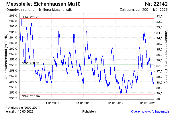
Groundwater level [m above sealevel]: 256.79
Distance to surface [m]: 38.63
Last value from 18.01.2026 10:00
Ground level [m above sealevel]: 295.42
| Date | Groundwater level [m above sealevel] |
|---|---|
| 18.01.2026 | 256.79 |
| 17.01.2026 | 256.79 |
| 16.01.2026 | 256.83 |
| 15.01.2026 | 256.85 |
| 14.01.2026 | 256.85 |
| 13.01.2026 | 256.87 |
| 12.01.2026 | 256.86 |
| 11.01.2026 | 256.79 |
© Bayerisches Landesamt für Umwelt 2026