
- Startseite >
- Seen >
- Wasserstand >
- Bayern >
- Ofenwaldsperre Seepegel >
- Monatsgrafik

Monatsgrafik Ofenwaldsperre Seepegel / Ofenwaldsperre
Wasserstand vom 01.08.2025 bis zum 31.08.2025
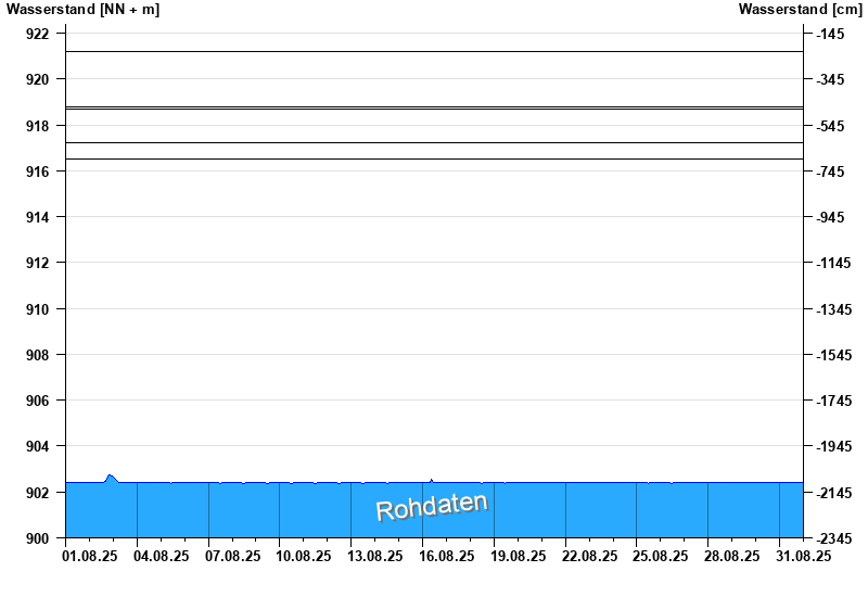
- 21.05.1999 Wasserstand: 921,21 m ü. NN
- 23.08.2005 Wasserstand: 918,80 m ü. NN
- 31.07.2024 Wasserstand: 918,69 m ü. NN
- 12.08.2002 Wasserstand: 917,23 m ü. NN
- 27.06.2001 Wasserstand: 916,49 m ü. NN
Linien: keine | Hauptwerte | Meldestufen | mittlerer Seespiegel | Hochwassermarken | historische Ereignisse
| Datum | Wasserstand [m ü. NN] |
|---|---|
| 01.09.2025 00:45 | 902,39 |
| 01.09.2025 00:30 | 902,39 |
| 01.09.2025 00:15 | 902,39 |
| 01.09.2025 00:00 | 902,40 |
| 31.08.2025 23:45 | 902,39 |
| 31.08.2025 23:30 | 902,39 |
| 31.08.2025 23:15 | 902,39 |
© Bayerisches Landesamt für Umwelt 2025