
- Startseite >
- Grundwasser >
- Quellschüttung >
- Bayern >
- Görisried Quelle Nord >
- Gesamtzeitraum

Gesamtzeitraum Görisried Quelle Nord
Quellschüttungen im Gesamtzeitraum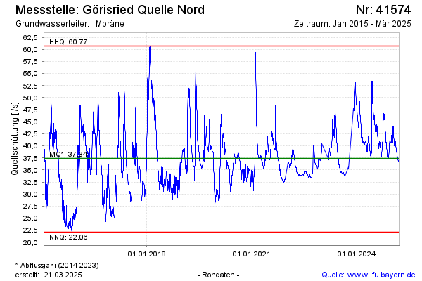
Schüttung [l/s]: 44,20
Letzter Messwert vom 25.07.2024 14:00
Geländehöhe [m ü. NN]: --
| Datum | Quellschüttung [l/s] |
|---|---|
| 25.07.2024 | 44,06 |
| 24.07.2024 | 43,66 |
| 23.07.2024 | 43,19 |
| 22.07.2024 | 42,98 |
| 21.07.2024 | 43,20 |
| 20.07.2024 | 43,49 |
| 19.07.2024 | 43,57 |
| 18.07.2024 | 43,79 |
© Bayerisches Landesamt für Umwelt 2024