
- Startseite >
- Grundwasser >
- Wasserstand oberes Stockwerk >
- Bayern >
- CHAM/STADELLOHE 867 >
- Gesamtzeitraum

Gesamtzeitraum CHAM/STADELLOHE 867
Grundwasserstände im Gesamtzeitraum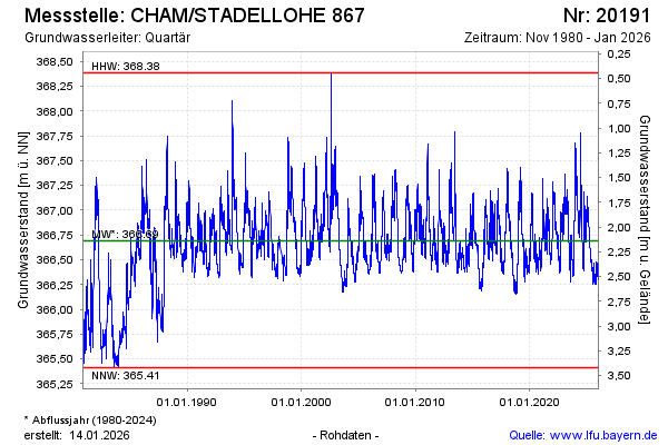
Grundwasserstand [m ü. NN]: 366,99
Flurabstand [m u. Gelände]: 1,84
Letzter Messwert vom 25.04.2024 10:00
Geländehöhe [m ü. NN]: 368,83
| Datum | Grundwasserstand [m ü. NN] |
|---|---|
| 25.04.2024 | 366,99 |
| 24.04.2024 | 367,00 |
| 23.04.2024 | 367,00 |
| 22.04.2024 | 366,99 |
| 21.04.2024 | 366,95 |
| 20.04.2024 | 366,91 |
| 19.04.2024 | 366,86 |
| 18.04.2024 | 366,80 |
© Bayerisches Landesamt für Umwelt 2024