
- Startseite >
- Flüsse >
- Wasserstand >
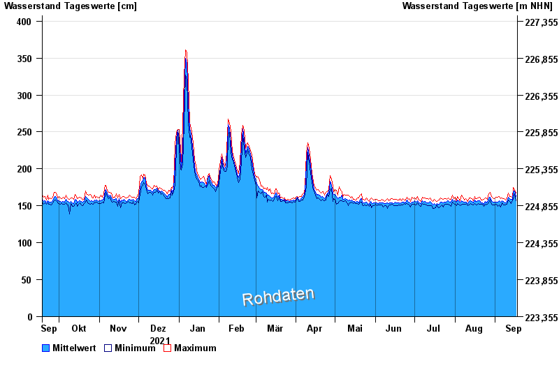
- Regnitz >
- Trunstadt >
- Jahresgrafik

Jahresgrafik Trunstadt / Main
Wasserstand vom 18.09.2021 bis zum 17.09.2022
- 04.01.2003 Wasserstand: 714 cm
- 07.01.1982 Wasserstand: 693 cm
- 27.01.1995 Wasserstand: 686 cm
- 15.01.2011 Wasserstand: 681 cm
- 27.03.1988 Wasserstand: 663 cm
| Datum | Mittelwert [cm] | Maximum [cm] | Minimum [cm] |
|---|---|---|---|
| 17.09.2022 | 163 | 167 | 157 |
| 16.09.2022 | 170 | 172 | 166 |
| 15.09.2022 | 169 | 175 | 160 |
| 14.09.2022 | 159 | 161 | 157 |
| 13.09.2022 | 159 | 163 | 153 |
| 12.09.2022 | 160 | 163 | 156 |
| 11.09.2022 | 162 | 167 | 158 |
© Bayerisches Landesamt für Umwelt 2024