
- Startseite >
- Flüsse >
- Wasserstand >
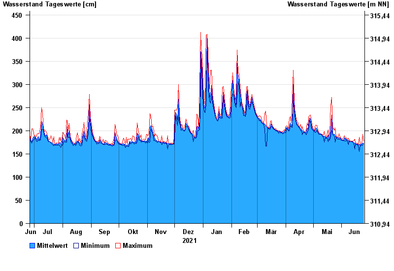
- Regnitz >
- Lauf >
- Jahresgrafik

Jahresgrafik Lauf / Pegnitz
Wasserstand vom 26.06.2021 bis zum 25.06.2022
- 26.01.1995 Wasserstand: 604 cm
- 21.12.1993 Wasserstand: 585 cm
- 25.03.1988 Wasserstand: 570 cm
- 13.01.2011 Wasserstand: 563 cm
- 02.03.1987 Wasserstand: 561 cm
| Datum | Mittelwert [cm] | Maximum [cm] | Minimum [cm] |
|---|---|---|---|
| 25.06.2022 | 173 | 178 | 171 |
| 24.06.2022 | 173 | 192 | 169 |
| 23.06.2022 | 171 | 172 | 169 |
| 22.06.2022 | 170 | 171 | 168 |
| 21.06.2022 | 171 | 173 | 169 |
| 20.06.2022 | 170 | 186 | 155 |
| 19.06.2022 | 169 | 170 | 167 |
© Bayerisches Landesamt für Umwelt 2024