
- Startseite >
- Flüsse >
- Wasserstand >
- Regnitz >
- Lauf >
- Jahresgrafik

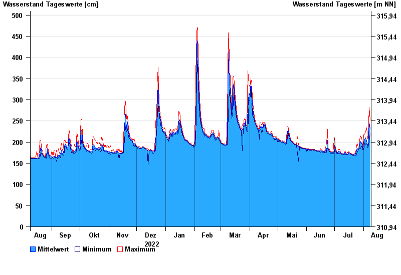
Jahresgrafik Lauf / Pegnitz
Wasserstand vom 09.08.2022 bis zum 08.08.2023
- 26.01.1995 Wasserstand: 604 cm
- 21.12.1993 Wasserstand: 585 cm
- 25.03.1988 Wasserstand: 570 cm
- 13.01.2011 Wasserstand: 563 cm
- 02.03.1987 Wasserstand: 561 cm
| Datum | Mittelwert [cm] | Maximum [cm] | Minimum [cm] |
|---|---|---|---|
| 08.08.2023 | 232 | 252 | 220 |
| 07.08.2023 | 246 | 282 | 201 |
| 06.08.2023 | 196 | 205 | 188 |
| 05.08.2023 | 193 | 208 | 187 |
| 04.08.2023 | 203 | 234 | 196 |
| 03.08.2023 | 210 | 224 | 195 |
| 02.08.2023 | 206 | 218 | 198 |
© Bayerisches Landesamt für Umwelt 2024