
- Startseite >
- Flüsse >
- Wasserstand >
- Untere Donau >
- Ruhstorf >
- Jahresgrafik

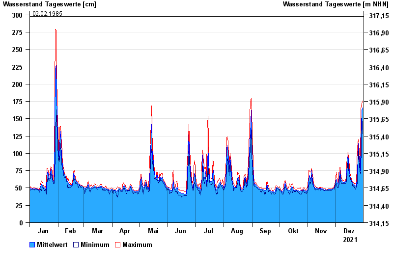
Jahresgrafik Ruhstorf / Rott
Wasserstand vom 01.01.2021 bis zum 31.12.2021
- 02.06.2016 Wasserstand: 366 cm
- 23.02.1970 Wasserstand: 344 cm
- 03.08.1991 Wasserstand: 340 cm
- 03.06.2013 Wasserstand: 331 cm
- 02.02.1985 Wasserstand: 298 cm
| Datum | Mittelwert [cm] | Maximum [cm] | Minimum [cm] |
|---|---|---|---|
| 31.12.2021 | 166 | 176 | 128 |
| 30.12.2021 | 162 | 172 | 153 |
| 29.12.2021 | 117 | 164 | 73 |
| 28.12.2021 | 75 | 82 | 70 |
| 27.12.2021 | 90 | 103 | 82 |
| 26.12.2021 | 114 | 120 | 103 |
| 25.12.2021 | 74 | 109 | 57 |
© Bayerisches Landesamt für Umwelt 2024