
- Startseite >
- Flüsse >
- Wasserstand >
- Untere Donau >
- Ruhstorf >
- Jahresgrafik

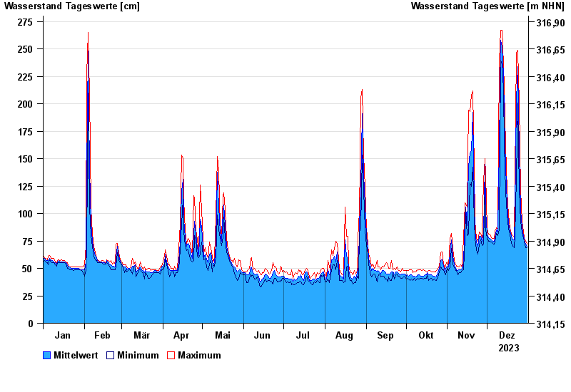
Jahresgrafik Ruhstorf / Rott
Wasserstand vom 01.01.2023 bis zum 31.12.2023
- 02.06.2016 Wasserstand: 366 cm
- 23.02.1970 Wasserstand: 344 cm
- 03.08.1991 Wasserstand: 340 cm
- 03.06.2013 Wasserstand: 331 cm
- 02.02.1985 Wasserstand: 298 cm
| Datum | Mittelwert [cm] | Maximum [cm] | Minimum [cm] |
|---|---|---|---|
| 31.12.2023 | 70 | 72 | 69 |
| 30.12.2023 | 72 | 75 | 69 |
| 29.12.2023 | 76 | 77 | 75 |
| 28.12.2023 | 80 | 84 | 77 |
| 27.12.2023 | 87 | 93 | 83 |
| 26.12.2023 | 103 | 121 | 93 |
| 25.12.2023 | 155 | 201 | 121 |
© Bayerisches Landesamt für Umwelt 2024