
- Startseite >
- Flüsse >
- Wasserstand >
- Untere Donau >
- Postmünster >
- Monatsgrafik

Monatsgrafik Postmünster / Rott
Wasserstand vom 21.04.2024 bis zum 20.05.2024
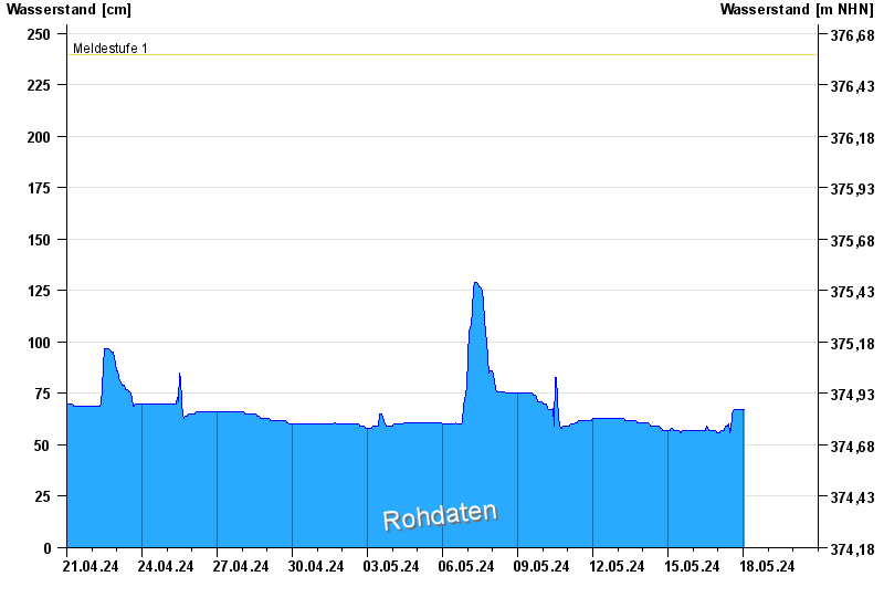
- Meldestufe 1 240 cm
- Meldestufe 2 280 cm
- Meldestufe 3 320 cm
- Meldestufe 4 370 cm
- Hochwassergefahrenfläche HQ100 460 cm
| Datum | Wasserstand [cm] |
|---|---|
| 03.05.2024 11:00 | 59 |
| 03.05.2024 10:45 | 56 |
| 03.05.2024 10:30 | 56 |
| 03.05.2024 10:15 | 57 |
| 03.05.2024 10:00 | 59 |
| 03.05.2024 09:45 | 59 |
| 03.05.2024 09:30 | 59 |
© Bayerisches Landesamt für Umwelt 2024