
- Startseite >
- Flüsse >
- Wasserstand >
- Untere Donau >
- Plattling >
- Jahresgrafik

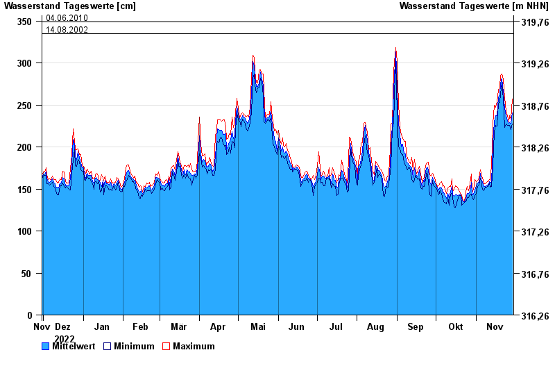
Jahresgrafik Plattling / Isar
Wasserstand vom 30.11.2022 bis zum 29.11.2023
- 04.06.2013 Wasserstand: 400 cm
- 24.05.1999 Wasserstand: 378 cm
- 25.08.2005 Wasserstand: 374 cm
- 04.06.2010 Wasserstand: 349 cm
- 14.08.2002 Wasserstand: 335 cm
| Datum | Mittelwert [cm] | Maximum [cm] | Minimum [cm] |
|---|---|---|---|
| 29.11.2023 | 241 | 257 | 227 |
| 28.11.2023 | 228 | 233 | 221 |
| 27.11.2023 | 229 | 237 | 226 |
| 26.11.2023 | 228 | 230 | 226 |
| 25.11.2023 | 231 | 237 | 226 |
| 24.11.2023 | 237 | 243 | 227 |
| 23.11.2023 | 246 | 259 | 223 |
© Bayerisches Landesamt für Umwelt 2024