
- Startseite >
- Flüsse >
- Wasserstand >
- Untere Donau >
- Plattling >
- Jahresgrafik

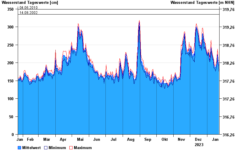
Jahresgrafik Plattling / Isar
Wasserstand vom 23.01.2023 bis zum 22.01.2024
- 04.06.2013 Wasserstand: 400 cm
- 24.05.1999 Wasserstand: 378 cm
- 25.08.2005 Wasserstand: 374 cm
- 04.06.2010 Wasserstand: 349 cm
- 14.08.2002 Wasserstand: 335 cm
| Datum | Mittelwert [cm] | Maximum [cm] | Minimum [cm] |
|---|---|---|---|
| 22.01.2024 | 193 | 205 | 176 |
| 21.01.2024 | 205 | 209 | 200 |
| 20.01.2024 | 223 | 238 | 202 |
| 19.01.2024 | 221 | 228 | 208 |
| 18.01.2024 | 197 | 208 | 191 |
| 17.01.2024 | 193 | 198 | 183 |
| 16.01.2024 | 186 | 195 | 176 |
© Bayerisches Landesamt für Umwelt 2024