
- Startseite >
- Flüsse >
- Wasserstand >
- Untere Donau >
- Plattling >
- Jahresgrafik

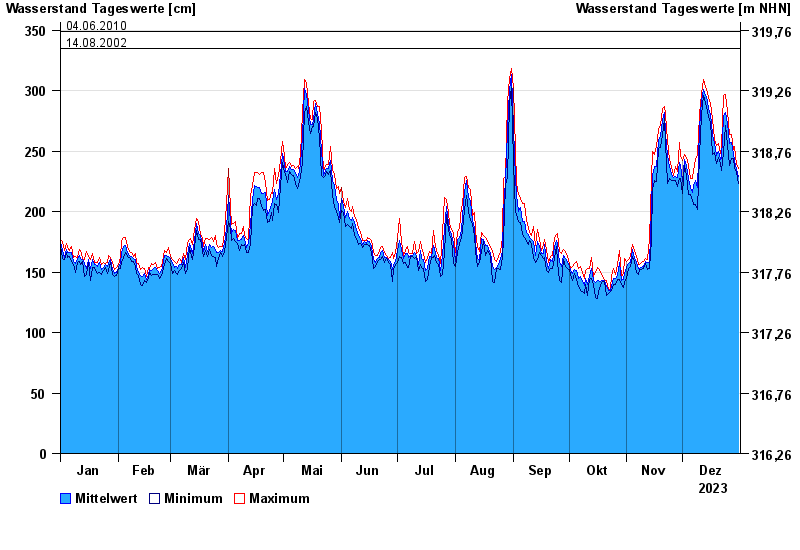
Jahresgrafik Plattling / Isar
Wasserstand vom 01.01.2023 bis zum 31.12.2023
- 04.06.2013 Wasserstand: 400 cm
- 24.05.1999 Wasserstand: 378 cm
- 25.08.2005 Wasserstand: 374 cm
- 04.06.2010 Wasserstand: 349 cm
- 14.08.2002 Wasserstand: 335 cm
| Datum | Mittelwert [cm] | Maximum [cm] | Minimum [cm] |
|---|---|---|---|
| 31.12.2023 | 229 | 236 | 223 |
| 30.12.2023 | 235 | 239 | 232 |
| 29.12.2023 | 242 | 254 | 236 |
| 28.12.2023 | 247 | 251 | 244 |
| 27.12.2023 | 257 | 264 | 244 |
| 26.12.2023 | 256 | 264 | 238 |
| 25.12.2023 | 273 | 283 | 255 |
© Bayerisches Landesamt für Umwelt 2024