
- Startseite >
- Flüsse >
- Wasserstand >
- Untere Donau >
- Passau Ingling >
- Jahresgrafik

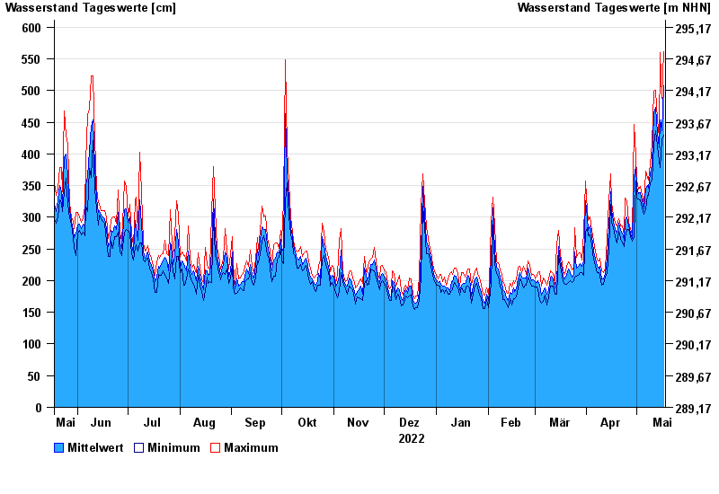
Jahresgrafik Passau Ingling / Inn
Wasserstand vom 18.05.2022 bis zum 17.05.2023
- Hochwassergefahrenfläche HQ100 1140 cm
| Datum | Mittelwert [cm] | Maximum [cm] | Minimum [cm] |
|---|---|---|---|
| 17.05.2023 | 507 | 562 | 429 |
| 16.05.2023 | 437 | 488 | 422 |
| 15.05.2023 | 454 | 560 | 378 |
| 14.05.2023 | 409 | 427 | 389 |
| 13.05.2023 | 433 | 453 | 413 |
| 12.05.2023 | 473 | 501 | 437 |
| 11.05.2023 | 465 | 499 | 414 |
© Bayerisches Landesamt für Umwelt 2024