
- Startseite >
- Flüsse >
- Wasserstand >
- Untere Donau >
- Passau Ingling >
- Jahresgrafik

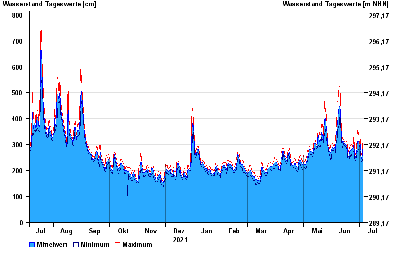
Jahresgrafik Passau Ingling / Inn
Wasserstand vom 06.07.2021 bis zum 05.07.2022
- Hochwassergefahrenfläche HQ100 1140 cm
| Datum | Mittelwert [cm] | Maximum [cm] | Minimum [cm] |
|---|---|---|---|
| 05.07.2022 | 295 | 326 | 252 |
| 04.07.2022 | 244 | 255 | 233 |
| 03.07.2022 | 255 | 274 | 242 |
| 02.07.2022 | 300 | 321 | 274 |
| 01.07.2022 | 292 | 302 | 279 |
| 30.06.2022 | 313 | 348 | 281 |
| 29.06.2022 | 312 | 357 | 275 |
© Bayerisches Landesamt für Umwelt 2024