
- Startseite >
- Flüsse >
- Wasserstand >
- Untere Donau >
- Kothmaißling >
- Monatsgrafik

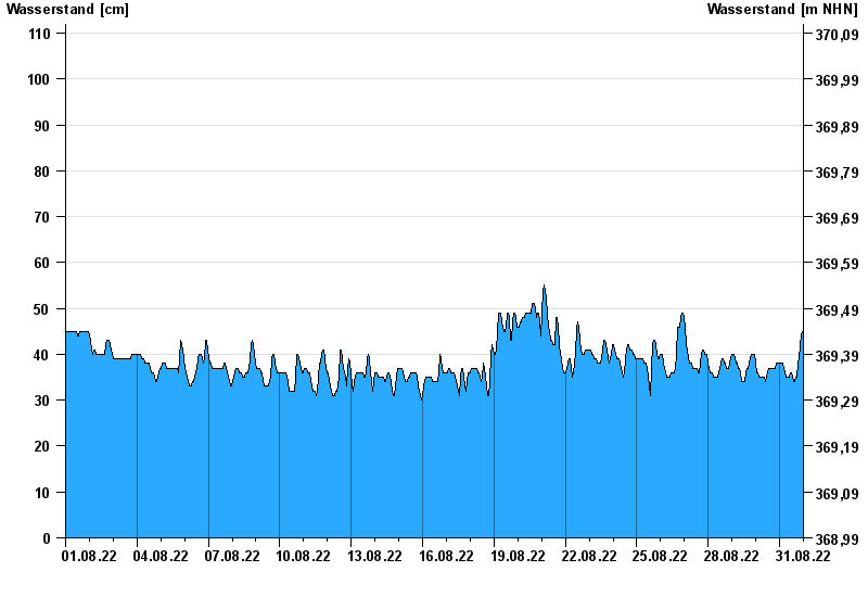
Monatsgrafik Kothmaißling / Chamb
Wasserstand vom 01.08.2022 bis zum 31.08.2022
Hinweis
Beeinflussung durch Buhneneinbau unterhalb vom Pegel
- 13.08.2002 Wasserstand: 364 cm
- 30.12.1986 Wasserstand: 341 cm
- 23.02.1970 Wasserstand: 338 cm
- 21.12.1993 Wasserstand: 332 cm
- 05.12.1988 Wasserstand: 329 cm
| Datum | Wasserstand [cm] |
|---|---|
| 01.09.2022 00:45 | 45 |
| 01.09.2022 00:30 | 45 |
| 01.09.2022 00:15 | 45 |
| 01.09.2022 00:00 | 45 |
| 31.08.2022 23:45 | 45 |
| 31.08.2022 23:30 | 45 |
| 31.08.2022 23:15 | 45 |
© Bayerisches Landesamt für Umwelt 2024