
- Startseite >
- Flüsse >
- Wasserstand >
- Untere Donau >
- Kothmaißling >
- Jahresgrafik

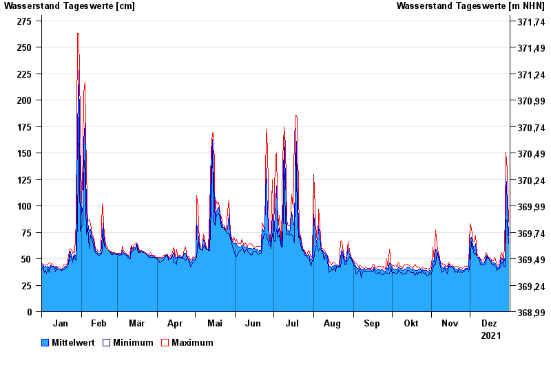
Jahresgrafik Kothmaißling / Chamb
Wasserstand vom 01.01.2021 bis zum 31.12.2021
Hinweis
Beeinflussung durch Buhneneinbau unterhalb vom Pegel
- 13.08.2002 Wasserstand: 364 cm
- 30.12.1986 Wasserstand: 341 cm
- 23.02.1970 Wasserstand: 338 cm
- 21.12.1993 Wasserstand: 332 cm
- 05.12.1988 Wasserstand: 329 cm
| Datum | Mittelwert [cm] | Maximum [cm] | Minimum [cm] |
|---|---|---|---|
| 31.12.2021 | 72 | 85 | 64 |
| 30.12.2021 | 104 | 134 | 85 |
| 29.12.2021 | 129 | 151 | 87 |
| 28.12.2021 | 51 | 87 | 43 |
| 27.12.2021 | 46 | 47 | 43 |
| 26.12.2021 | 50 | 54 | 47 |
| 25.12.2021 | 51 | 56 | 44 |
© Bayerisches Landesamt für Umwelt 2024