
- Startseite >
- Flüsse >
- Wasserstand >
- Untere Donau >
- Aham >
- Aktuelle Messwerte

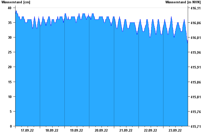
Aktuelle Messwerte Aham / Vils
Wasserstand vom 17.09.2022 bis zum 23.09.2022
- Hochwassergefahrenfläche HQ100 220 cm
| Datum | Wasserstand [cm] |
|---|---|
| 24.09.2022 00:45 | 30 |
| 24.09.2022 00:30 | 29 |
| 24.09.2022 00:15 | 29 |
| 24.09.2022 00:00 | 29 |
| 23.09.2022 23:45 | 29 |
| 23.09.2022 23:30 | 28 |
| 23.09.2022 23:15 | 29 |
© Bayerisches Landesamt für Umwelt 2024