
- Startseite >
- Flüsse >
- Wasserstand >
- Naab - Regen >
- Schwabelweis >
- Jahresgrafik

Jahresgrafik Schwabelweis / Donau
Wasserstand vom 18.04.2024 bis zum 17.04.2025
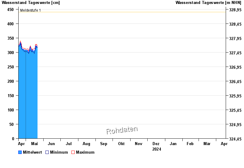
- Meldestufe 1 440 cm
- Meldestufe 2 470 cm
- Meldestufe 3 530 cm
- Meldestufe 4 570 cm
- Hochwassergefahrenfläche HQ100 740 cm
| Datum | Mittelwert [cm] | Maximum [cm] | Minimum [cm] |
|---|---|---|---|
| 30.04.2024 | 309 | 309 | 307 |
| 29.04.2024 | 308 | 315 | 303 |
| 28.04.2024 | 308 | 311 | 302 |
| 27.04.2024 | 310 | 313 | 306 |
| 26.04.2024 | 312 | 316 | 308 |
| 25.04.2024 | 312 | 317 | 308 |
| 24.04.2024 | 315 | 319 | 311 |
© Bayerisches Landesamt für Umwelt 2024