
- Startseite >
- Flüsse >
- Wasserstand >
- Naab - Regen >
- Plattling >
- Jahresgrafik

Jahresgrafik Plattling / Isar
Wasserstand vom 06.06.2021 bis zum 05.06.2022
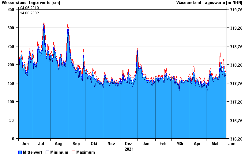
- 04.06.2013 Wasserstand: 400 cm
- 24.05.1999 Wasserstand: 378 cm
- 25.08.2005 Wasserstand: 374 cm
- 04.06.2010 Wasserstand: 349 cm
- 14.08.2002 Wasserstand: 335 cm
| Datum | Mittelwert [cm] | Maximum [cm] | Minimum [cm] |
|---|---|---|---|
| 05.06.2022 | 177 | 192 | 168 |
| 04.06.2022 | 177 | 181 | 170 |
| 03.06.2022 | 179 | 183 | 176 |
| 02.06.2022 | 181 | 195 | 168 |
| 01.06.2022 | 184 | 192 | 180 |
| 31.05.2022 | 196 | 215 | 180 |
| 30.05.2022 | 185 | 194 | 176 |
© Bayerisches Landesamt für Umwelt 2024