
- Startseite >
- Flüsse >
- Wasserstand >
- Naab - Regen >
- Hof >
- Jahresgrafik

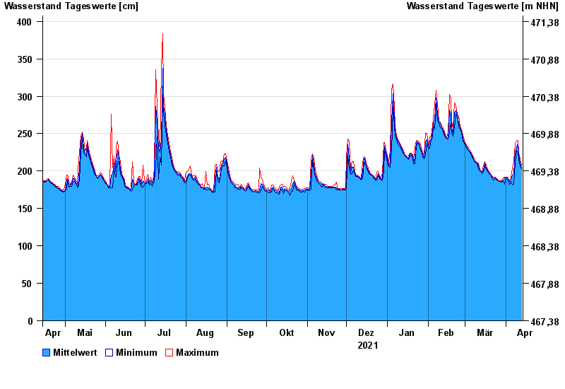
Jahresgrafik Hof / Sächsische Saale
Wasserstand vom 14.04.2021 bis zum 13.04.2022
- 15.08.1924 Wasserstand: 428 cm
- 09.02.1946 Wasserstand: 420 cm
- 14.01.2011 Wasserstand: 416 cm
- 11.07.1954 Wasserstand: 414 cm
- 28.12.1947 Wasserstand: 410 cm
| Datum | Mittelwert [cm] | Maximum [cm] | Minimum [cm] |
|---|---|---|---|
| 13.04.2022 | 205 | 208 | 202 |
| 12.04.2022 | 211 | 216 | 207 |
| 11.04.2022 | 221 | 225 | 215 |
| 10.04.2022 | 236 | 241 | 225 |
| 09.04.2022 | 232 | 240 | 228 |
| 08.04.2022 | 227 | 237 | 212 |
| 07.04.2022 | 197 | 214 | 182 |
© Bayerisches Landesamt für Umwelt 2024