
- Startseite >
- Flüsse >
- Wasserstand >
- Naab - Regen >
- Hof >
- Jahresgrafik

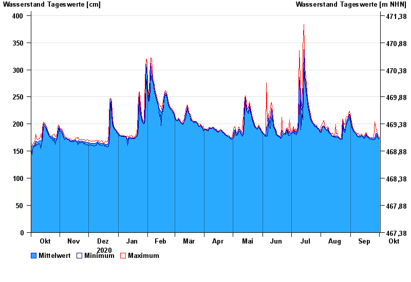
Jahresgrafik Hof / Sächsische Saale
Wasserstand vom 02.10.2020 bis zum 01.10.2021
- 15.08.1924 Wasserstand: 428 cm
- 09.02.1946 Wasserstand: 420 cm
- 14.01.2011 Wasserstand: 416 cm
- 11.07.1954 Wasserstand: 414 cm
- 28.12.1947 Wasserstand: 410 cm
| Datum | Mittelwert [cm] | Maximum [cm] | Minimum [cm] |
|---|---|---|---|
| 01.10.2021 | 174 | 176 | 173 |
| 30.09.2021 | 176 | 179 | 173 |
| 29.09.2021 | 179 | 181 | 176 |
| 28.09.2021 | 182 | 188 | 180 |
| 27.09.2021 | 183 | 192 | 174 |
| 26.09.2021 | 174 | 204 | 171 |
| 25.09.2021 | 173 | 175 | 171 |
© Bayerisches Landesamt für Umwelt 2024