
- Startseite >
- Flüsse >
- Wasserstand >
- Unterer Main >
- Würzburg >
- Jahresgrafik

Jahresgrafik Würzburg / Main
Wasserstand vom 17.04.2024 bis zum 16.04.2025
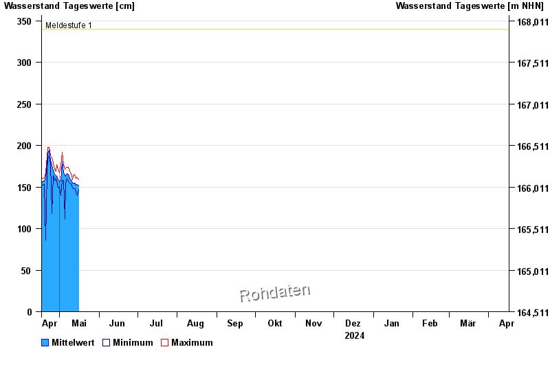
- Meldestufe 1 340 cm
- Meldestufe 2 400 cm
- Meldestufe 3 510 cm
- Meldestufe 4 600 cm
- Hochwassergefahrenfläche HQhäufig 590 cm
- Hochwassergefahrenfläche HQ100 820 cm
| Datum | Mittelwert [cm] | Maximum [cm] | Minimum [cm] |
|---|---|---|---|
| 29.04.2024 | 165 | 177 | 157 |
| 28.04.2024 | 163 | 169 | 160 |
| 27.04.2024 | 165 | 171 | 157 |
| 26.04.2024 | 170 | 179 | 164 |
| 25.04.2024 | 175 | 186 | 118 |
| 24.04.2024 | 183 | 188 | 179 |
| 23.04.2024 | 194 | 198 | 186 |
© Bayerisches Landesamt für Umwelt 2024