
- Startseite >
- Flüsse >
- Wasserstand >
- Unterer Main >
- Trunstadt >
- Jahresgrafik

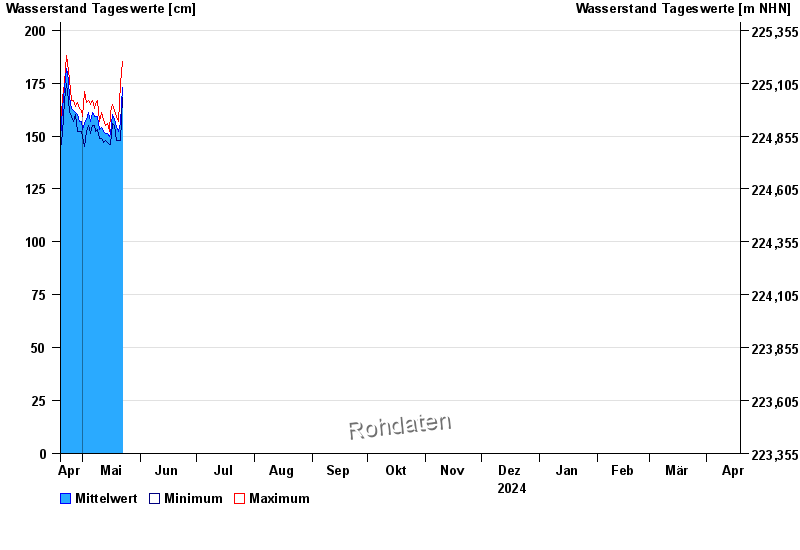
Jahresgrafik Trunstadt / Main
Wasserstand vom 19.04.2024 bis zum 18.04.2025
- 04.01.2003 Wasserstand: 714 cm
- 07.01.1982 Wasserstand: 693 cm
- 27.01.1995 Wasserstand: 686 cm
- 15.01.2011 Wasserstand: 681 cm
- 27.03.1988 Wasserstand: 663 cm
| Datum | Mittelwert [cm] | Maximum [cm] | Minimum [cm] |
|---|---|---|---|
| 11.06.2024 | 160 | 160 | 160 |
| 10.06.2024 | 163 | 168 | 159 |
| 09.06.2024 | 166 | 169 | 164 |
| 08.06.2024 | 176 | 186 | 169 |
| 07.06.2024 | 198 | 210 | 182 |
| 06.06.2024 | 222 | 233 | 208 |
| 05.06.2024 | 251 | 276 | 231 |
© Bayerisches Landesamt für Umwelt 2024