
- Startseite >
- Flüsse >
- Wasserstand >
- Unterer Main >
- Schweinfurt Neuer Hafen >
- Jahresgrafik

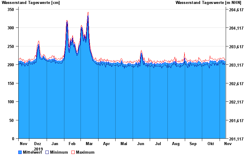
Jahresgrafik Schweinfurt Neuer Hafen / Main
Wasserstand vom 12.11.2019 bis zum 11.11.2020
- 24.02.1970 Wasserstand: 697 cm
- 05.01.2003 Wasserstand: 672 cm
- 16.01.2011 Wasserstand: 654 cm
- 07.01.1982 Wasserstand: 651 cm
- 28.01.1995 Wasserstand: 645 cm
| Datum | Mittelwert [cm] | Maximum [cm] | Minimum [cm] |
|---|---|---|---|
| 11.11.2020 | 210 | 215 | 204 |
| 10.11.2020 | 208 | 212 | 200 |
| 09.11.2020 | 210 | 218 | 200 |
| 08.11.2020 | 212 | 218 | 206 |
| 07.11.2020 | 211 | 218 | 201 |
| 06.11.2020 | 210 | 218 | 201 |
| 05.11.2020 | 213 | 217 | 209 |
© Bayerisches Landesamt für Umwelt 2024