
- Startseite >
- Flüsse >
- Wasserstand >
- Unterer Main >
- Gemünden Lachsfangsteg >
- Jahresgrafik

Jahresgrafik Gemünden Lachsfangsteg / Sinn
Wasserstand vom 01.01.2024 bis zum 27.04.2024
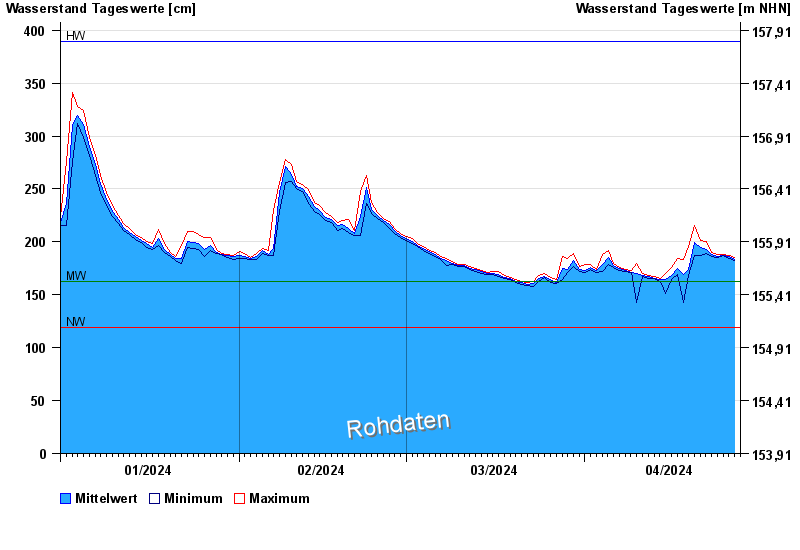
| Datum | Mittelwert [cm] | Maximum [cm] | Minimum [cm] |
|---|---|---|---|
| 27.04.2024 | 185 | 185 | 184 |
| 26.04.2024 | 186 | 187 | 184 |
| 25.04.2024 | 187 | 188 | 187 |
| 24.04.2024 | 186 | 188 | 185 |
| 23.04.2024 | 188 | 190 | 186 |
| 22.04.2024 | 193 | 200 | 189 |
| 21.04.2024 | 195 | 201 | 187 |
 weitere Messwerte weitere Messwerte | |||

© Bayerisches Landesamt für Umwelt 2024