
- Startseite >
- Flüsse >
- Wasserstand >
- Unterer Main >
- Astheim >
- Jahresgrafik

Jahresgrafik Astheim / Main
Wasserstand vom 01.01.2017 bis zum 31.12.2017
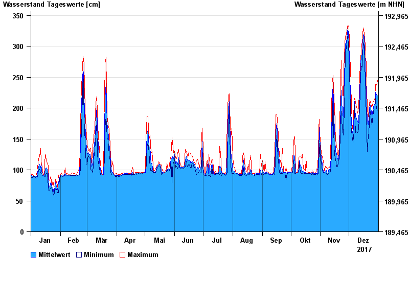
| Datum | Mittelwert [cm] | Maximum [cm] | Minimum [cm] |
|---|---|---|---|
| 31.12.2017 | 220 | 245 | 197 |
| 30.12.2017 | 222 | 237 | 199 |
| 29.12.2017 | 226 | 238 | 216 |
| 28.12.2017 | 207 | 217 | 198 |
| 27.12.2017 | 205 | 212 | 199 |
| 26.12.2017 | 197 | 209 | 188 |
| 25.12.2017 | 187 | 201 | 173 |
© Bayerisches Landesamt für Umwelt 2024