
- Startseite >
- Flüsse >
- Wasserstand >
- Unterer Main >
- Astheim >
- Jahresgrafik

Jahresgrafik Astheim / Main
Wasserstand vom 01.01.2023 bis zum 31.12.2023
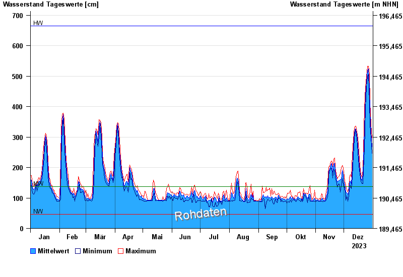
| Datum | Mittelwert [cm] | Maximum [cm] | Minimum [cm] |
|---|---|---|---|
| 31.12.2023 | 268 | 298 | 246 |
| 30.12.2023 | 317 | 341 | 297 |
| 29.12.2023 | 382 | 415 | 341 |
| 28.12.2023 | 462 | 506 | 415 |
| 27.12.2023 | 524 | 533 | 506 |
| 26.12.2023 | 519 | 533 | 497 |
| 25.12.2023 | 479 | 497 | 465 |
© Bayerisches Landesamt für Umwelt 2024