
- Startseite >
- Flüsse >
- Wasserstand >
- Unterer Main >
- Astheim >
- Jahresgrafik

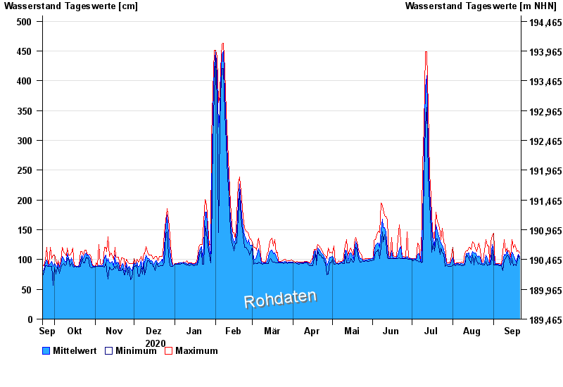
Jahresgrafik Astheim / Main
Wasserstand vom 22.09.2020 bis zum 21.09.2021
- 16.01.2011 Wasserstand: 665 cm
- 05.01.2003 Wasserstand: 663 cm
- 25.02.1970 Wasserstand: 627 cm
- 08.01.1982 Wasserstand: 624 cm
- 28.01.1995 Wasserstand: 623 cm
| Datum | Mittelwert [cm] | Maximum [cm] | Minimum [cm] |
|---|---|---|---|
| 21.09.2021 | 105 | 111 | 102 |
| 20.09.2021 | 109 | 115 | 106 |
| 19.09.2021 | 100 | 113 | 95 |
| 18.09.2021 | 96 | 118 | 90 |
| 17.09.2021 | 102 | 125 | 92 |
| 16.09.2021 | 108 | 119 | 90 |
| 15.09.2021 | 112 | 133 | 102 |
© Bayerisches Landesamt für Umwelt 2024