
- Startseite >
- Flüsse >
- Wasserstand >
- Unterer Main >
- Astheim >
- Jahresgrafik

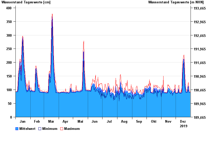
Jahresgrafik Astheim / Main
Wasserstand vom 01.01.2019 bis zum 31.12.2019
- 16.01.2011 Wasserstand: 665 cm
- 05.01.2003 Wasserstand: 663 cm
- 25.02.1970 Wasserstand: 627 cm
- 08.01.1982 Wasserstand: 624 cm
- 28.01.1995 Wasserstand: 623 cm
| Datum | Mittelwert [cm] | Maximum [cm] | Minimum [cm] |
|---|---|---|---|
| 31.12.2019 | 90 | 92 | 90 |
| 30.12.2019 | 92 | 95 | 90 |
| 29.12.2019 | 94 | 97 | 90 |
| 28.12.2019 | 95 | 110 | 90 |
| 27.12.2019 | 114 | 128 | 100 |
| 26.12.2019 | 110 | 115 | 97 |
| 25.12.2019 | 94 | 99 | 90 |
© Bayerisches Landesamt für Umwelt 2024