
- Startseite >
- Flüsse >
- Wasserstand >
- Obere Donau >
- Plattling >
- Jahresgrafik

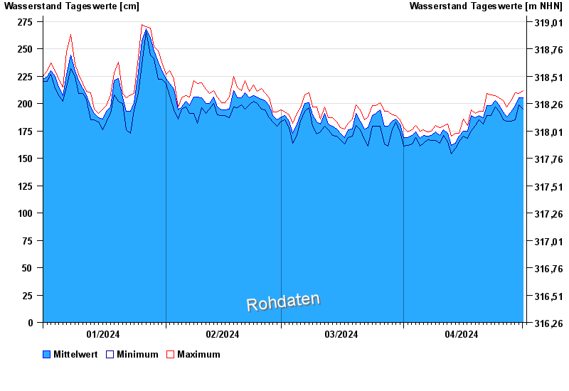
Jahresgrafik Plattling / Isar
Wasserstand vom 01.01.2024 bis zum 01.05.2024
- 04.06.2013 Wasserstand: 400 cm
- 24.05.1999 Wasserstand: 378 cm
- 25.08.2005 Wasserstand: 374 cm
- 04.06.2010 Wasserstand: 349 cm
- 14.08.2002 Wasserstand: 335 cm
| Datum | Mittelwert [cm] | Maximum [cm] | Minimum [cm] |
|---|---|---|---|
| 01.05.2024 | 204 | 210 | 195 |
| 30.04.2024 | 205 | 209 | 199 |
| 29.04.2024 | 198 | 210 | 185 |
| 28.04.2024 | 192 | 203 | 184 |
| 27.04.2024 | 188 | 197 | 184 |
| 26.04.2024 | 192 | 203 | 185 |
| 25.04.2024 | 199 | 205 | 193 |
© Bayerisches Landesamt für Umwelt 2024