
- Startseite >
- Flüsse >
- Wasserstand >
- Obere Donau >
- Plattling >
- Jahresgrafik

Jahresgrafik Plattling / Isar
Wasserstand vom 01.01.2024 bis zum 31.12.2024
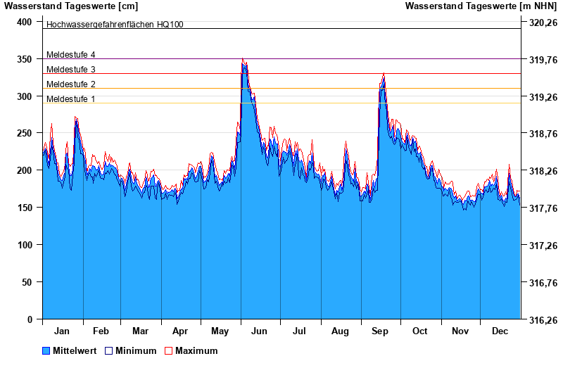
- Meldestufe 1 290 cm
- Meldestufe 2 310 cm
- Meldestufe 3 330 cm
- Meldestufe 4 350 cm
- Hochwassergefahrenfläche HQ100 390 cm
| Datum | Mittelwert [cm] | Maximum [cm] | Minimum [cm] |
|---|---|---|---|
| 15.06.2024 | 252 | 257 | 247 |
| 14.06.2024 | 258 | 263 | 250 |
| 13.06.2024 | 262 | 270 | 251 |
| 12.06.2024 | 279 | 290 | 267 |
| 11.06.2024 | 301 | 305 | 282 |
| 10.06.2024 | 297 | 304 | 290 |
| 09.06.2024 | 297 | 305 | 292 |
© Bayerisches Landesamt für Umwelt 2024