
- Startseite >
- Flüsse >
- Wasserstand >
- Obere Donau >
- Mühlried >
- Jahresgrafik

Jahresgrafik Mühlried / Paar
Wasserstand vom 01.01.2024 bis zum 31.12.2024
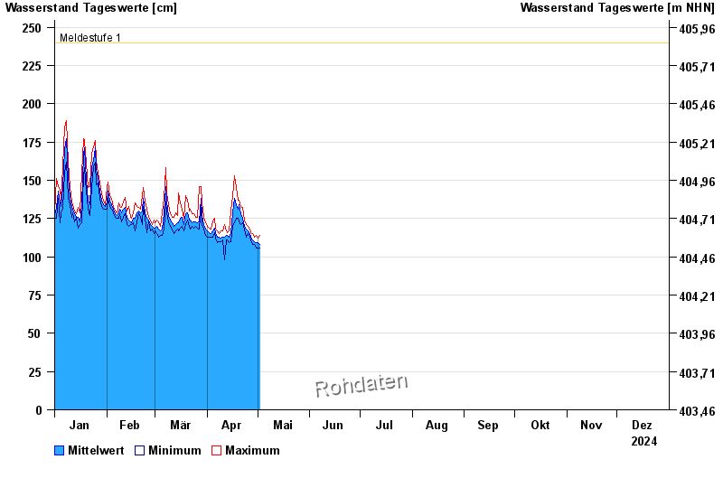
- Meldestufe 1 240 cm
- Meldestufe 2 260 cm
- Meldestufe 3 310 cm
- Meldestufe 4 330 cm
| Datum | Mittelwert [cm] | Maximum [cm] | Minimum [cm] |
|---|---|---|---|
| 07.06.2024 | 289 | 291 | 288 |
| 06.06.2024 | 295 | 303 | 287 |
| 05.06.2024 | 309 | 315 | 301 |
| 04.06.2024 | 322 | 329 | 316 |
| 03.06.2024 | 338 | 352 | 329 |
| 02.06.2024 | 371 | 386 | 352 |
| 01.06.2024 | 318 | 381 | 264 |
© Bayerisches Landesamt für Umwelt 2024